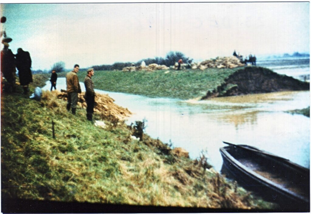
Billinghay and the surrounding area have always been susceptible to flooding due to the low lying nature of the land around. Indeed Billinghay would have been an island ar certain times of the year. Drainage of the fens to provide more farming land improved the position but even today the area can flood.
A major development in the area towards the end of the 18th Century was the draining of the Fens. Acts of Parliament for improving the River Witham were passed in 1672, 1762 and 1812. These must have benefited Billinghay but the main change affecting the village followed the Enclosure Act of 1777.
Considerable drainage works were carried out with the enclosure. For this purpose Commissioners were empowered to borrow money and between October 1777 and August 1778 they borrowed £2,600 from Lord Fitzwilliam (The Lord of the Manor). Fitzwilliam Place in the village is named after the family. Unfortunately, this did not completely resolve the problem.
A report in 1800 stated that four of the previous six years had been so wet that inundation of water had caused crops to be lost or badly damaged. In 1799, it was bad enough to necessitate hundreds of acres of crops being harvested from boats.
In 1840, there was another Act of Parliament to improve the drainage of the fenland areas around Billinghay. Again this did not prove to be 100% successful.
In 1877, there was disastrous flood when an embankment gave way and inundated 3000 acres of fenland to the depth of 8 feet. 300 people were made temporarily homeless and damage was estimated at £2000 (a vast sum in those days). To start the repair three barges were sunk across the gap thus giving some idea of the size of the breach.
The damage and the effect on the local population caused the following appeal to be published in the local press:
The Revd. E. Jenkins, Vicar of Billinghay, appeals for help on behalf of his unfortunate parishioners who are suffering from the present calamitous floods. In consequence of an important embankment giving way upwards of 3,000 acres of fenland in a high state of cultivation are under water, in some places to the depth of eight feet. Three hundred people including women and children are thus deprived of their homes and must be so for a long time to come.
Their last year’s crops are in many cases completely destroyed and the autumn sown wheat it is feared will perish. Several of their homes are undermined and giving way. These unfortunate sufferers are thus deprived of their means of existence and are reduced to a state of distress far exceeding anything known in the memory of the oldest inhabitants.
In January 1939 very close to the site of the 1877 disaster, local people discovered a bank in imminent danger of collapse. Men worked day and night for two and a half days to strengthen the flood defences to prevent a recurrence of the earlier disaster.
In more modern times, there is still an ever present danger of floods. As recently as 1960 and 1977 there were incidents as can be seen from the picture at the beginning and below:
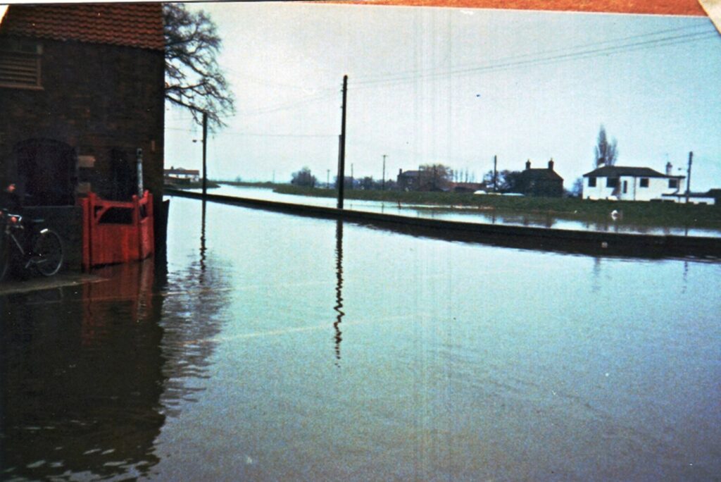
There were also problems in 1981, as can be seen from the extract below that appeared in the Sleaford Standard:
Billinghay was one of the worst hit villages in the area when heavy rains resulted in flooding. Four inches of rain fell in Lincolnshire between Friday and Sunday creating the most serious floods since 1947.
Obviously the reporter was not aware of the problems in Billinghay in 1960 and 1977!
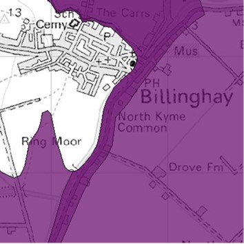
Although improved drainage work is a continuous process the danger of flooding still persists. Indeed, the flood status of the area shown below is checked by the Environment Agency every 15 minutes.
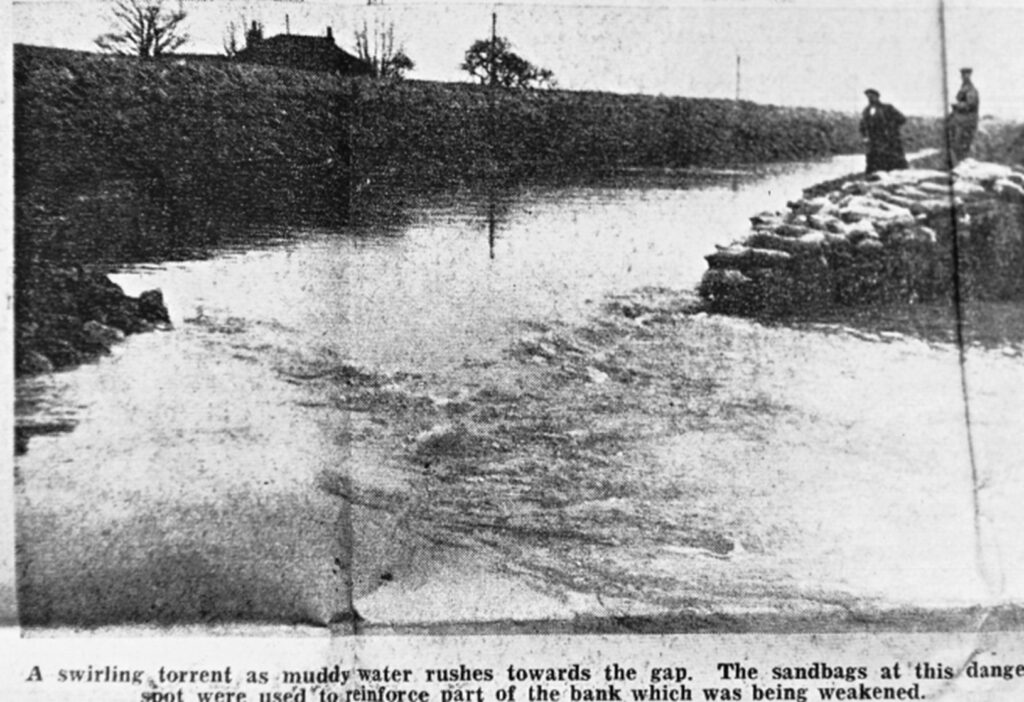
The 1960 Flood was well documented in the local press at the time with the photograph below appearing in the Lincolnshire Echo:
Since then there has been further inundations the most recent being at the end of 2019 and the beginning of 2020 resulting in extensive works being carried out to prevent a recurrence. These floods resulted in the highest ever river level ever recorded at Billinghay
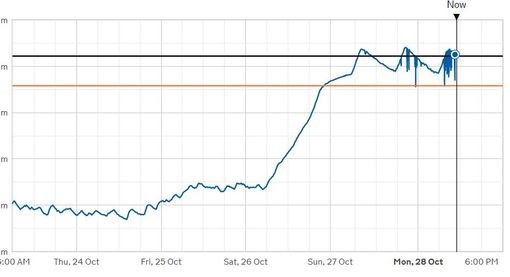
The river was measured at 2.70m yesterday evening, Sunday, October 27 and is at 2.68m this morning. This breaks the highest level ever recorded of 2.60m.
The river was measured at 2.70m yesterday evening, Sunday, October 27 and is at 2.68m this morning. This breaks the highest level ever recorded of 2.60m.
In the image the black line represents the highest figure ever recorded. he orange line represents that some minor flooding will happen if water reaches this level.
